The winter in Buffalo and Western New York has been relatively mild compared to what it could have been. However, the constant back-and-forth between milder conditions and winter weather in March has been frustrating for many people.
Get ready for another round of winter weather in the Northeast and Western New York as chilly blasts of air and additional flurries and snow squalls are expected during the latter part of March.
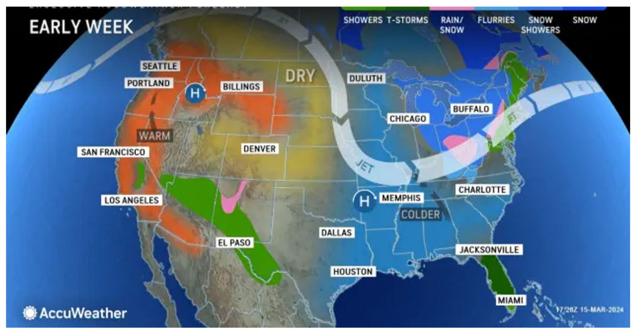
AccuWeather Meteorologist Brandon Buckingham predicts that the prolonged period of unusually warm weather will soon come to a close in the Midwest and Northeast. This change is expected to be caused by a storm moving down from Canada.
The colder air will arrive just before the official start of astronomical spring on Tuesday, March 19, at 11:06 p.m.
According to forecasters at the National Weather Service in Buffalo, Saint Patrick’s Day is expected to be colder with a brisk wind and persistent clouds, which may result in a few nuisance rain or snow showers. Looking ahead, below-normal temperatures and lake effect snow showers are anticipated for the first half of next week.
The St. Patrick’s Day Parade in Buffalo on Sunday will have temperatures ranging from the low to mid 40’s. Throughout the afternoon, there will be consistent wind gusts of 30-35 mph, resulting in wind chill values that will feel close to freezing.
The work week will kick off with a wintry atmosphere, bringing a chilly sensation in the air. In certain areas southeast of Lake Erie, there is a chance of snow showers, which could result in minor accumulations in specific locations.
Temperatures during the majority of the work week will be approximately 10 degrees below the average, but they may approach the average as we near the end of the week.


