Friday in Alabama will be dominated by rain, with the possibility of a few strong to severe storms near the coast.
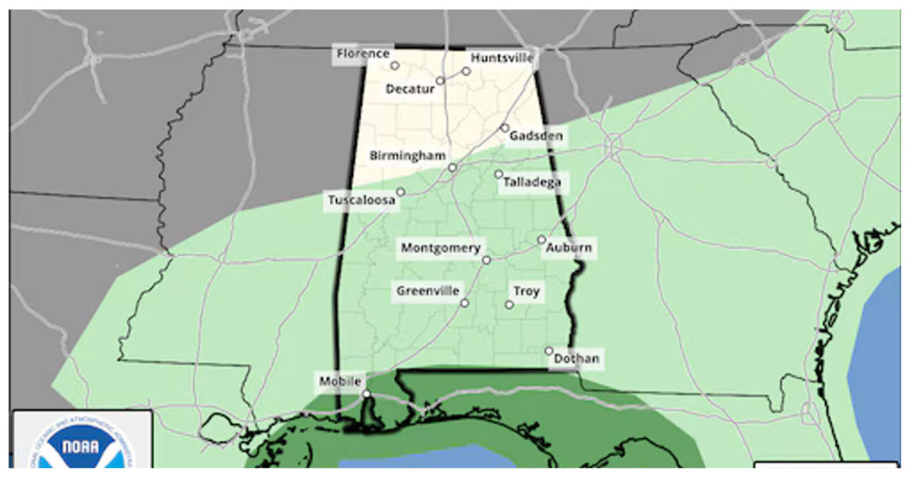
The Storm Prediction Center of NOAA has issued a Level 1 risk for severe weather on Friday, specifically along the coasts of Alabama and northwest Florida. This risk mainly affects Mobile and Baldwin counties in Alabama.
Isolated severe storms could potentially occur when there is a Level 1 (or marginal) risk.
According to the National Weather Service in Mobile, there is a possibility of wind gusts up to 40 mph and hail near the coast.
Rain and storms are expected to become more widespread across south Alabama this morning as an area of low pressure approaches. A line of stronger storms may develop near the coast and move through the region from west to east, generally between 10 a.m. and 3 p.m.
Today, beachgoers along the Alabama and northwest Florida coasts should be aware of another potential hazard – rip currents. The risk of rip currents is high in these areas, posing a dangerous threat to swimmers and surfers.
The weather service mentioned that there will be rough surf along the coast, with waves measuring 3 to 5 feet.
There is a chance of a few rumbles of thunder across south Alabama and the southern part of central Alabama. However, it is not expected that these storms will be severe.
The weather service predicts that rain will persist throughout the day as an area of low pressure makes its way across the state. In certain regions, the rain might extend into Saturday morning. Rainfall totals are expected to vary, ranging from a small amount to as much as an inch.
Despite the clouds and rain, temperatures are expected to be mild statewide.
Weather service forecasts indicate that temperatures will remain relatively mild through the weekend and into next week.
Severe weather is not expected in Alabama for the next week.


