A Pacific storm will be arriving over Southern California on Friday evening, bringing with it “spotty” showers throughout the weekend.
Northern California will receive heavy rainfall from the system, but it will not directly impact the Southland region.
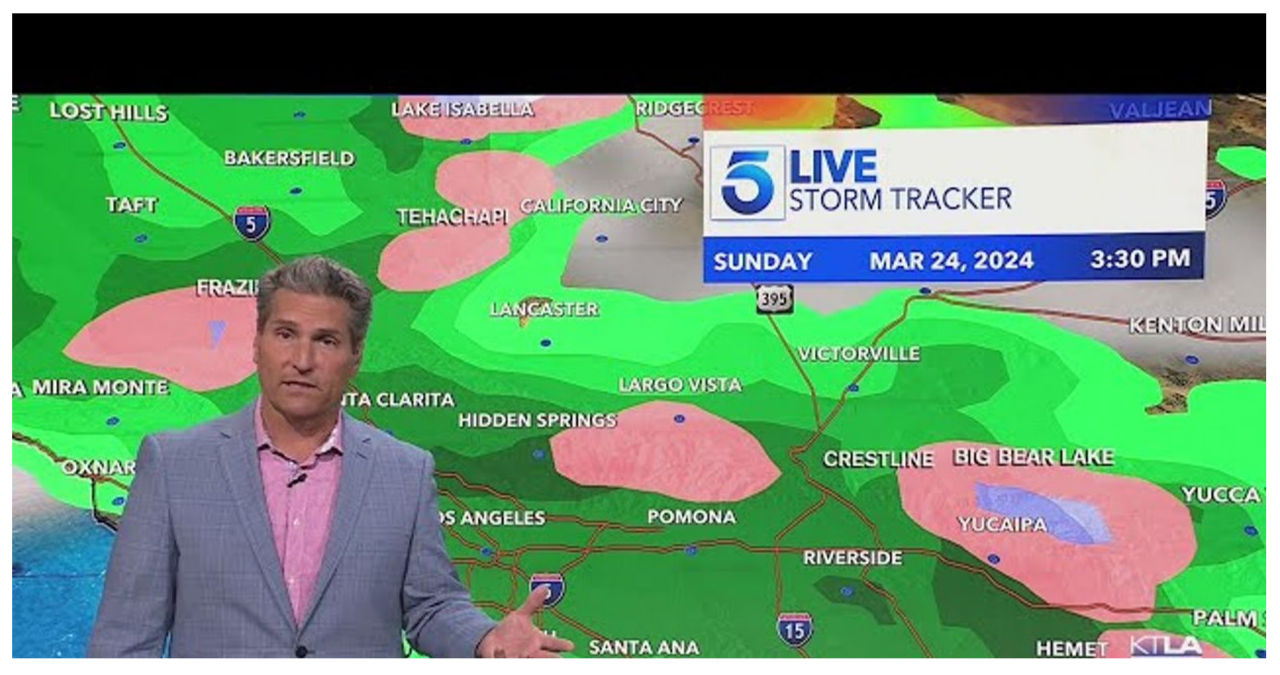
According to KTLA Meteorologist Henry DiCarlo, we can expect some light to moderate showers as we experience the tail end of the cold front. Although the rainfall will be sporadic, it will still bring some much-needed precipitation.
KTLA’s Storm Tracker reveals intermittent showers arriving in waves over the weekend on Saturday and Sunday.
Henry expressed his frustration with the forecast, emphasizing the need for flexibility in making plans.
The National Weather Service forecasted that there would be approximately a quarter of an inch of rain over the course of two days, specifically south of Point Conception.
According to Henry, thunderstorms are unpredictable. He mentioned that a sudden thunderstorm could increase the amount of rainfall in a specific area to nearly an inch.
The arrival of this storm is also bringing much cooler temperatures for the weekend.
The afternoon highs in the Inland Empire are expected to decrease by 15 degrees, going from 74 degrees on Friday to 59 degrees on Saturday.
Snow levels are expected to remain around 6,000 feet initially but are anticipated to decrease to approximately 4,000 feet by Sunday, creating a potential snowfall issue for the Grapevine area.
According to the Weather Service, the stormy weather is expected to clear out by Monday.


