70 million Americans in the Northeast and Midwest are expected to be affected by severe weather from Sunday to Tuesday.
According to the Storm Prediction Center, a multi-region storm system has been designated as an enhanced risk for severe weather, with a level 3 out of 5 risk.
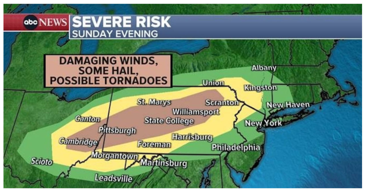
Intense thunderstorms are expected to develop in the Northeast during the late Sunday afternoon. This will likely occur in a corridor stretching across the upper Ohio Valley, the Pocono Mountains in Pennsylvania, and the Catskill region in Upstate New York.
The storm is expected to bring damaging wind, hail, and the possibility of tornadoes as it moves southward throughout Sunday evening.
A line of strong to potentially severe storms is expected to affect cities from Pittsburgh to New York on Sunday night, from 10:00 p.m. ET to 11:00 p.m. ET.
A powerful weather system is expected to sweep across the Midwest, affecting the Rockies and the Great Plains from the Dakotas to Texas. This system has the potential to create severe storms that could develop into supercells, bringing with them the risk of large hail, destructive winds, and even tornadoes on Monday.
There is a high chance of scattered severe thunderstorms across the southern to central Great Plains, particularly on Monday evening. During this time, we can expect the possibility of large hail, damaging wind, and a few tornadoes.
Severe weather is expected to start as early as 5:00 p.m. CT, stretching from Central Texas to Nebraska. These storms will then intensify overnight throughout the area.
Tuesday morning is expected to bring storms to eastern Nebraska, Kansas City, Missouri, and parts of Iowa. These storms have the potential to be strong and severe.
Tuesday afternoon is expected to bring the most powerful storms to regions spanning from Des Moines, Iowa, to Columbia, Missouri.
Expect scattered severe thunderstorms to occur on Tuesday throughout the evening, stretching from Chicago to the eastern part of Dallas.
Strong to severe storms could still be present in the Ohio River Valley on Wednesday morning.


