Mocobizscene- The East Coast cities are already experiencing the effects of a powerful storm system. This system is anticipated to bring heavy rainfall, strong winds, and intense thunderstorms. The system hit Florida and South Carolina hard over the weekend, and its effects are predicted to linger until Monday.
According to the National Weather Service Tampa Bay, the Tampa Bay area experienced coastal flooding due to heavy rainfall on Saturday.
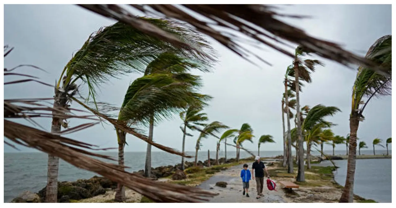
By noon on Sunday, over 33,000 customers in the state were left without power, as reported by PowerOutage.us. However, there was a significant decrease in this number as power restoration efforts commenced. By Sunday night, the number of customers in the dark dropped to less than 2,000.
On Sunday, the city of Charleston, South Carolina, experienced record-breaking rainfall. According to the weather service, the downtown area recorded an impressive 3.86 inches of rainfall.
According to the National Weather Service (NWS), Charleston Harbor experienced an impressive tide of 9.86 feet. This remarkable measurement marks the fourth-highest tide ever recorded in the area. What makes this tide even more noteworthy is that it was not caused by a tropical system, setting it apart from the previous highest tides.
The heavy rain downtown has resulted in multiple road closures, prompting the Charleston Police Department to advise drivers to avoid travelling if they can. Videos captured in Myrtle Beach and Cherry Grove, South Carolina, depict street flooding and powerful winds. Storm chaser Andrew Elswick shared these videos on X, noting that the winds were so intense that they caused his car to shake. In one of the videos, he remarked, “This is what most places look like. The water is rising quite significantly.”
The National Weather Service office in Sterling, Virginia, reported that the Washington, D.C., area experienced moderate rainfall leading up to the system. In just three hours on Sunday night, as much as 1.25 inches of rain fell, and there is a possibility of more rainfall in the forecast.
The region was under a flash flood watch until 6 a.m. Monday, according to the statement.
The weather service forecasters in Philadelphia mentioned on social media platform X on Sunday night that the region will experience the most severe rain and winds in the next few hours.
The Metropolitan Transportation Authority in New York City is getting ready for the arrival of heavy rain and strong gusts of wind on Sunday night. They are preparing their crews to remove any trees that potentially fall onto the train tracks.
From 10 p.m. on Sunday to 2 p.m. on Monday, the MTA will implement a restriction on empty tractor-trailers and tandem trucks, prohibiting them from crossing bridges and entering tunnels. The city has also released a travel advisory for Sunday and Monday, cautioning about the potential for coastal flooding to reach up to 1 or 2 feet by Sunday night.
“As we anticipate heavy rainfall and strong winds on Sunday and Monday, it is important for all New Yorkers to remain vigilant, stay updated on the weather forecast, and be prepared,” emphasized Mayor Eric Adams in a press release. “Before the onset of strong winds, securing any loose items outdoors is advisable. Additionally, individuals residing in low-lying areas and places with inadequate drainage should exercise extra caution.”
Parts of Maine are also expecting heavy rain. According to the National Weather Service for Portland and Gray, there will be “significant rainfall” on Sunday night into Monday in the mountains and foothills, resulting in increased river levels originating from these areas.
According to the weather service, strong, potentially damaging winds are expected to pick up on Monday. Additionally, coastal flooding is possible during high tide on Monday, while inland areas may experience flooding due to the combination of rainfall and snowmelt.
According to federal forecasters, the reason behind the intense precipitation along the coast is an “intense low pressure system.” This system is responsible for drawing moisture from the warmer Atlantic waters and creating a spinning effect. As the storm moves along, cold air is expected to fill in.
Also Read:
- East Coast Bracing For Severe Storm With Strong Winds And Heavy Rainfall
- Weeklong Forecast for Miami Predicts Storms, Rain, and Strong Winds
- Connecticut Experiences Its Largest Christmas Snowstorm in History


